13/11/2026
Geospatial Software Engineer Career Path UK: GIS, Mapping Technologies and Data Skills
What Does a Geospatial Software Engineer Do?
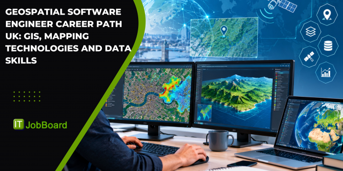
A Geospatial Software Engineer develops software and applications that collect, process, analyse and visualise location-based data. In the UK, these professionals combine software engineering, Geographic Information Systems (GIS), spatial databases, mapping technologies and data analysis to build tools used across transport, infrastructure, environmental monitoring, logistics and urban planning.
Unlike a traditional software developer who may work mainly with general business applications, a geospatial software engineer works with information connected to physical locations. This can include coordinates, satellite imagery, road networks, property boundaries, environmental measurements and geographical datasets.
The role involves developing mapping applications, integrating location services, building spatial data pipelines and creating systems that help organisations understand geographical information.
As organisations increasingly use location intelligence to support operational and planning decisions, geospatial software engineering offers a specialist career direction for software developers, GIS professionals and data engineers.
Why Are Geospatial Software Engineering Skills Important in the UK?
Location-based data plays an important role in many UK industries. Organisations use geospatial technology to understand where assets are located, how people and goods move, how environments change and where infrastructure may be needed.
Some important application areas include:
- Transport and logistics: Mapping road networks, analysing routes and supporting transport planning.
- Construction and infrastructure: Managing site information, geographical surveys and infrastructure assets.
- Environmental monitoring: Analysing land use, flooding, pollution and changes in natural environments.
- Public services: Supporting local planning, emergency response and geographical service analysis.
- Utilities: Mapping electricity, water, gas and telecommunications infrastructure.
- Retail and commercial planning: Using location intelligence to assess customer access and potential business locations.
The UK has a developed geospatial ecosystem involving public authorities, technology companies, infrastructure organisations, research institutions and specialist mapping providers.
The UK Geospatial Strategy highlights the importance of location data and geospatial capabilities in supporting economic growth, public services and innovation.
For software professionals, this creates opportunities to apply programming and data engineering skills to real-world geographical challenges.
What Skills Are Required to Become a Geospatial Software Engineer?
A Geospatial Software Engineer needs a combination of software development, spatial data management and geographical knowledge.
1. Programming Skills
Programming is central to developing geospatial applications and automating geographical data workflows.
Important programming languages include:
- Python: Used for spatial data processing, automation and GIS development.
- JavaScript: Useful for interactive web maps and location-based applications.
- SQL: Important for querying and managing spatial databases.
- Java and C++: Relevant to certain enterprise systems and performance-focused applications.
Developers should also understand software engineering fundamentals such as APIs, testing, version control, debugging and application architecture.
2. Geographic Information Systems (GIS)
GIS is a core technology area for geospatial software development. It allows professionals to manage, analyse and visualise information associated with geographical locations.
Important GIS concepts include:
- Coordinate reference systems
- Vector and raster data
- Spatial analysis
- Geocoding
- Map projections
- Geospatial data visualisation
- Geographic data formats
Experience with GIS platforms can help candidates understand how geographical datasets are structured and used in practical applications.
3. Spatial Databases
Geospatial applications often process large datasets containing location information. Engineers need to understand how to store, query and manage this information efficiently.
Relevant technologies include:
- PostgreSQL
- PostGIS
- Spatial SQL
- GeoJSON
- Spatial indexing
- Database optimisation
PostGIS is particularly relevant because it extends PostgreSQL with capabilities for storing and analysing geographical objects.
The PostGIS documentation provides technical guidance on spatial data types, functions and database operations.
4. Mapping APIs and Web Technologies
Many geospatial applications use web-based maps to display geographical information to users.
Useful technologies include:
- Leaflet
- MapLibre
- OpenLayers
- Mapbox
- OpenStreetMap data
- REST APIs
- HTML, CSS and JavaScript
Experience with mapping APIs can help developers build interactive dashboards, route visualisations, asset management applications and location-based services.
5. Cloud and Data Engineering Skills
Geospatial systems may process large volumes of satellite imagery, sensor data and geographical records. Cloud and data engineering skills can therefore be valuable.
Relevant areas include:
- Cloud storage and data processing
- Data pipelines
- Distributed computing
- API integration
- Containerisation
- Data quality management
- Automated deployment
These skills are particularly useful in organisations building scalable geospatial platforms.
Which Tools and Technologies Should Geospatial Software Engineers Learn?
The tools required depend on the employer and the type of geospatial application being developed.
|
Technology
|
How it is used
|
|
QGIS
|
Open-source GIS mapping and spatial analysis
|
|
ArcGIS
|
Professional GIS and spatial data management
|
|
Python
|
Geospatial automation and data processing
|
|
PostGIS
|
Spatial database management
|
|
GeoPandas
|
Working with geographical data in Python
|
|
GDAL
|
Processing raster and vector geospatial formats
|
|
Leaflet
|
Interactive web mapping
|
|
MapLibre
|
Open-source interactive mapping
|
|
Google Maps Platform
|
Location-based applications and mapping services
|
|
Cloud platforms
|
Hosting and processing geospatial data
|
Candidates do not need to learn every platform. A strong foundation in Python, SQL, GIS concepts and one mapping technology can provide a practical starting point.
The QGIS documentation and GeoPandas documentation are useful resources for developing practical knowledge.
What Qualifications Are Useful for Geospatial Software Engineer Jobs in the UK?
There is no single mandatory degree for every geospatial software engineering position. Employers may recruit candidates from software development, geography, GIS, computer science, surveying, mathematics and engineering backgrounds.
Relevant academic subjects include:
- Computer Science
- Software Engineering
- Geographic Information Science
- Geography
- Geomatics
- Data Science
- Civil Engineering
- Environmental Science
- Mathematics
A degree in Computer Science combined with practical GIS experience can be relevant to software-focused roles. Similarly, someone with a geography or GIS background may develop programming skills to move towards geospatial software engineering.
Professional learning can also help candidates demonstrate technical capability. Relevant training may cover GIS platforms, spatial databases, Python programming, remote sensing and web mapping.
The Royal Geographical Society provides information about geography-related careers, professional development and the wider geospatial sector.
What Does a Geospatial Software Engineer Career Path Look Like?
The career path depends on a person's starting background and the type of organisation they join.
Entry-level roles
- Junior GIS Developer
- Graduate Software Developer
- GIS Technician
- Junior Geospatial Analyst
- Graduate Geospatial Engineer
Developing specialist experience
- Geospatial Software Developer
- GIS Software Engineer
- Spatial Data Engineer
- Geospatial Application Developer
- Location Intelligence Developer
Experienced professional roles
- Senior Geospatial Software Engineer
- Geospatial Solutions Architect
- Lead GIS Developer
- Geospatial Data Engineering Lead
- Geospatial Technology Consultant
Some professionals may progress into technical leadership, enterprise architecture, spatial data management or specialist consulting.
These job titles are examples of related career directions. Actual titles and responsibilities vary between employers.
Which Industries Employ Geospatial Software Engineers in the UK?
Geospatial software engineering is relevant to several industries that depend on accurate location data.
Transport and Logistics
Transport organisations use geospatial systems for route planning, network analysis, fleet management and infrastructure monitoring. Software engineers may develop applications that combine maps, transport datasets and real-time information.
Construction and Infrastructure
Construction and engineering projects use geographical data for site planning, land surveys, infrastructure design and asset management. Geospatial software can help connect survey information with project management and engineering systems.
Environmental and Climate Research
Environmental organisations use location-based datasets to monitor land changes, habitats, water resources and environmental conditions. Geospatial developers may create systems that process satellite imagery and environmental measurements.
Utilities and Telecommunications
Utility providers use GIS platforms to manage infrastructure assets and geographical networks. Engineers may develop software that supports asset mapping, maintenance planning and network analysis.
Government and Public Services
Public authorities use geospatial information for planning, transport, emergency response and public service delivery. The Ordnance Survey is an important UK organisation providing geospatial data and mapping services.
How Can Candidates Prepare for Geospatial Software Engineer Jobs in the UK?
Candidates should combine general software engineering knowledge with practical geospatial experience.
A structured preparation approach includes:
- Learn Python, JavaScript and SQL fundamentals.
- Understand GIS concepts, coordinate systems and spatial data formats.
- Practise using QGIS or another GIS platform.
- Learn PostgreSQL and PostGIS.
- Build a simple web mapping application using a mapping library.
- Explore public geographical datasets.
- Develop a portfolio showing how you process and visualise location-based information.
- Learn how APIs and cloud services support geospatial applications.
A useful portfolio project could be an interactive map displaying public transport stops, geographical boundaries or environmental information. Another project could demonstrate how a spatial database answers questions about distances, locations or geographical areas.
Candidates should explain the data sources, technical decisions and limitations of each project. This helps employers assess both programming ability and practical problem-solving skills.
What Is the Future of Geospatial Software Engineering Careers in the UK?
Geospatial technology is developing alongside cloud computing, artificial intelligence, remote sensing, digital twins and real-time data systems.
Potential areas of development include:
- Automated processing of satellite imagery
- AI-assisted geographical data analysis
- Smart city applications
- Infrastructure digital twins
- Real-time transport monitoring
- Environmental data platforms
- Location-based analytics
These developments may increase the need for professionals who can connect geographical information with software systems and data platforms.
However, geospatial software engineering is not limited to new technologies. Organisations will continue to need reliable systems for managing, validating, updating and visualising geographical data.
For software developers, learning GIS and spatial programming can provide a route into a specialist technical field. For GIS professionals, strengthening programming and software architecture skills can create opportunities to move into application development and engineering roles.
Key Takeaways
- Geospatial Software Engineers develop applications that process, analyse and visualise location-based data.
- Python, JavaScript, SQL and GIS knowledge are important technical foundations.
- PostGIS, QGIS, ArcGIS, GeoPandas and mapping APIs are relevant tools.
- Transport, construction, utilities, environmental research and public services use geospatial technology.
- Computer Science, Geography, GIS and Engineering are relevant educational backgrounds.
- Practical mapping applications and spatial database projects can strengthen a candidate's portfolio.
- The combination of software engineering and location intelligence creates opportunities across the UK's geospatial sector.
Frequently Asked Questions
1. What does a Geospatial Software Engineer do?
A Geospatial Software Engineer develops software that manages, processes and visualises geographical information. The work may involve GIS applications, spatial databases, mapping APIs, location-based services and geographical data pipelines.
2. Which programming languages are used in geospatial software engineering?
Python, JavaScript and SQL are commonly relevant. Python supports spatial data processing, JavaScript is useful for interactive web maps, and SQL is used to query spatial databases.
3. Do I need a GIS degree to become a Geospatial Software Engineer in the UK?
No. A GIS or Geography degree can be useful, but Computer Science, Software Engineering, Data Science and Engineering backgrounds can also be relevant. Practical GIS and programming skills are important.
4. What is the difference between a GIS Developer and a Geospatial Software Engineer?
A GIS Developer generally focuses on building and customising GIS applications and workflows. A Geospatial Software Engineer may work across a broader software engineering scope, including spatial databases, APIs, cloud systems, data pipelines and mapping platforms. Responsibilities can overlap.
5. Which tools should I learn for geospatial software engineering jobs?
Useful tools include Python, QGIS, PostGIS, GeoPandas, GDAL and web mapping libraries such as Leaflet or MapLibre. The best combination depends on the job requirements and the type of geospatial systems an employer develops.